Riding on Cloud Nine
Almost all the training I do, both running and biking, I do a loop. Out-and-backs are boring. And de-motivating. It just doesn't do it for me when I get to the turnaround point of an out-and-back and I know I have to do it all over again - the exact same thing all over again. And on the way out, it's tempting to turn around early. What difference does it make? A loop keeps things interesting, and also gives a greater sense of completion.
So when you're at Lake Tahoe, it's almost a reflex to look at a map of the lake and picture a route that goes around the whole thing.
Just to see if it was do-able, I used MapMyRide.com to plot a route. 70 miles and 3,133 feet of climbing. Longer than an average day on Texas 4,000, and with a lot more climbing, but only a little longer than a weekend ride for me, and only half the climbing. Then my uncle Doug said it was 75 miles. And upon arriving in Lake Tahoe, I was to learn that where I was staying was a 3.5 miles off the loop and at the top of a giant hill. Whatever. Let's do this thing.
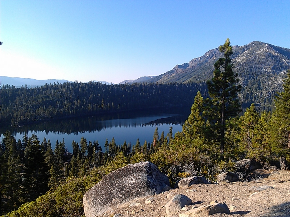
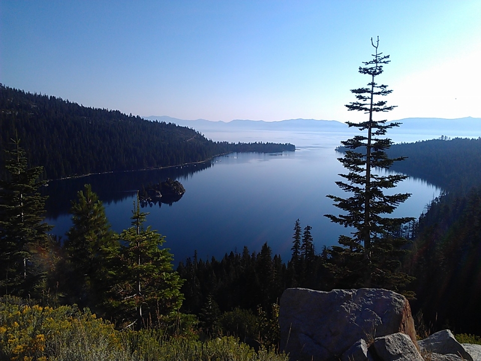
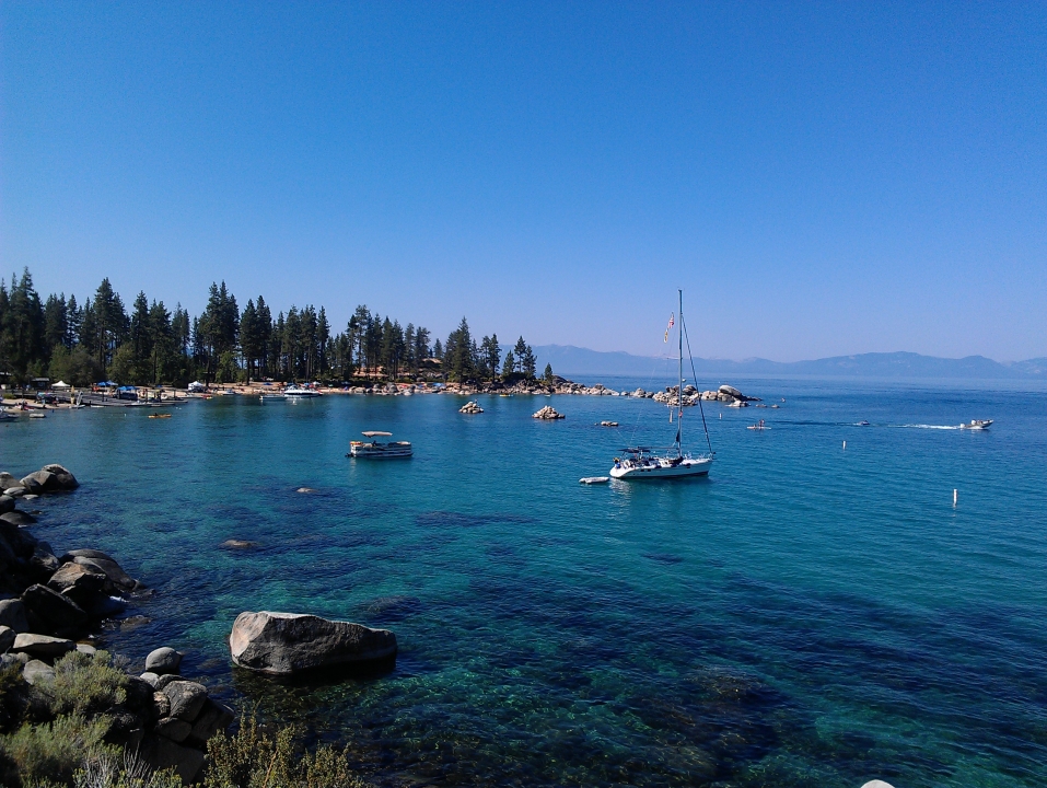
I started early, about 6:45 AM, descended the giant hill to get to the main road (getting rather cold in the process), and headed around the southern end of the lake first. After seeing all the summer tourist traffic the day before, I wanted to get through South Lake Tahoe (the biggest city on the lake) and Emerald Bay (the most popular scenic point on the lake) as early as possible. Luckily made it through with little traffic. Saw a few other bikers heading up the hills to Emerald Bay. Most of them passed me, because I kept stopping to take pictures.
At one of the overlooks, I saw what was probably a middle-aged son and his father. Apparently the son is also a cyclist, but it sounded like he focuses more on mountain biking, and both of them were hikers. They asked where I was headed.
"Around the lake."
"The whole thing??"
"Yeah."
"Good for you!"
I explained that I was doing this part early on to avoid traffic. They nodded; they obviously knew that was a good idea. The son warned me that I'd see a lot of traffic around Spooner Lake.
"Yeah, that's where you'll be late in the afternoon." It didn't cross his mind that I'd be done before 12:00. "There'll be a ton of cars on 50, so that'll scare the bejeezus outta you."
"Well, doesn't 50 have two lanes, so it's easier for them to pass?"
"Yeah."
"And a shoulder?"
"Uh, I think so."
"I'll be fine. I've gotten fearless over the years. Well, smart, but also comfortable."
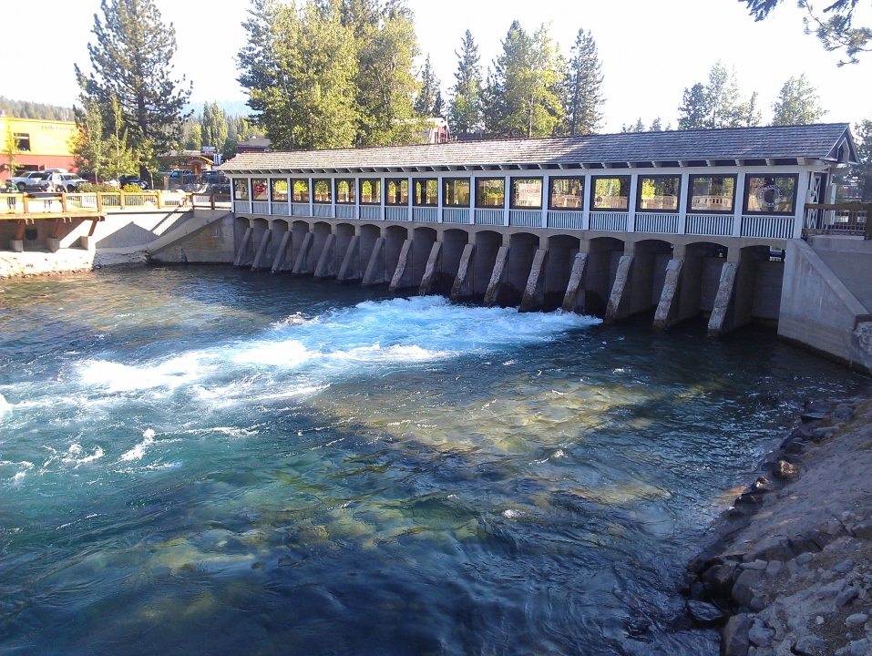
For the next several miles, virtually flat, almost no traffic, and no other bikes either. Basically a lot of trees, easy moving, and good views of the lake, until I got to Tahoe City. All of a sudden, the traffic picked up, and I started seeing other bikes too. Tahoe City also happens to be the location of the dam that holds in Lake Tahoe.
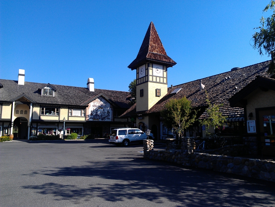
One of the weirder things about the north side of the lake, or at least one of the more unexpected things, was that not only was it a lot more urban/populated than I thought, but there were a LOT of Mexican restaurants there. Or at the very least, a lot of places that advertised taco nights or something like that.
Unsurprisingly, the second you cross the state border and get into Nevada - BAM, casinos. It was finally starting to get warm out. I drank from my water bottle for the first time, more than halfway into the ride.
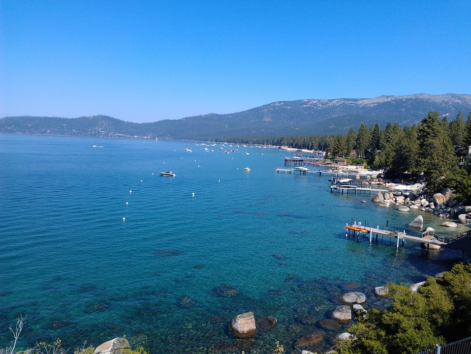
Coming back down the eastern side of the lake, the shallow water near the shore was GORGEOUS. The road I was on didn't have much of a shoulder, probably only about 60 cm wide, but I kept stopping for pictures anyway. I mean, the water looked tropical, for Pete's sake!
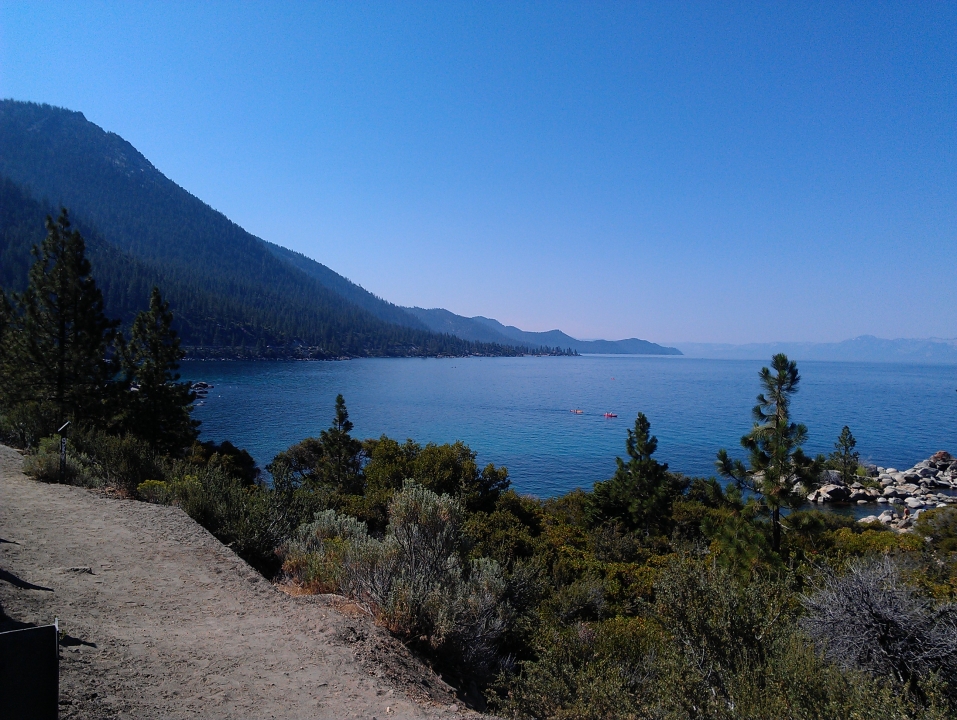
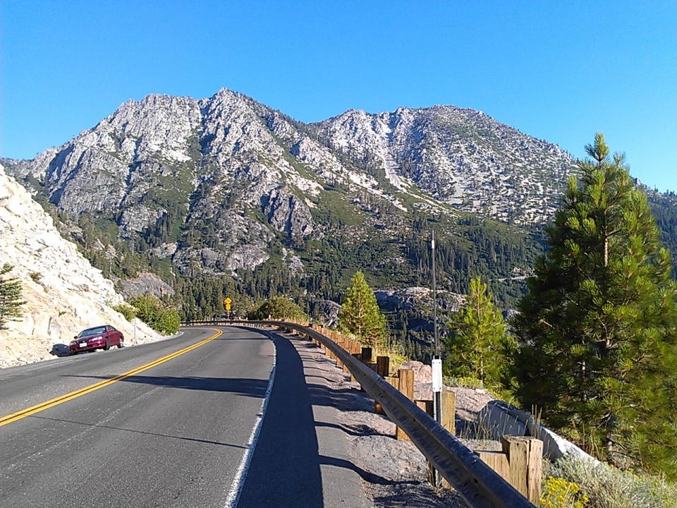
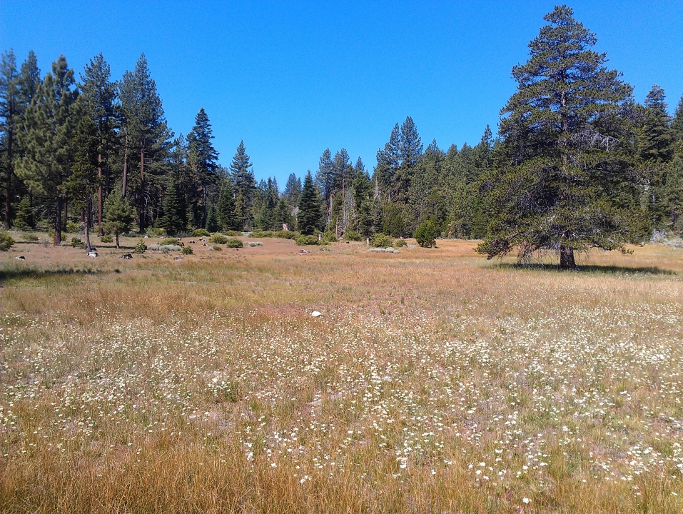
The road turned away from the lake, which always means uphill. It wasn't steep, but the hill went on for probably six or seven miles. Less than pleasant. At the top would be Spooner Lake, around which I was warned there would be a lot of traffic. But you know what? There wasn't much. There were a few nice meadows instead.
Was happy to see highway 50, knowing that meant the worst of the climbing was over. Well, almost. There was still the issue of that gigantic hill to get back to the house. But I didn't want to think about that yet. Three miles of coasting later, including a tunnel, I was back down to lake level. About five miles before I turn off the lake loop. Right away, a strong uphill.
"Oh, no, it better not be like this the whole way leading up to the big hill!" Then I managed to remind myself that the big hill started at lake level, so no matter how bad these five miles are, only half of them can be uphill.
Those five miles had more than their share of ups and downs, and by the time I reached the turn to start the big hill, my legs were merely going through the motions. I was slowing down, losing energy.
Four miles. 1,200 feet. Only 300 feet shy of an average day of climbing on Texas 4,000's Rockies route, and here I am trying to do it in four miles. Yeah, this is gonna be fun.
I wish I could tell a good story here, but there's not one. I threw it in my lowest gear (for inquiring minds, that would be 39-27), tried to stay patient, and kept my feet moving. It was hard. It was slow. It was getting hot outside. Probably close to half an hour later, I was at the top. And that's how it's done - no glory, no tricks, nothing special really. Just a lot of persistence. That's how to get a lot of things done.
In the end, it turned out to be 81 miles, with 5,854 feet of climbing. I ate some yogurt, drank some water, and took a shower. And later that day, went back to Spooner Lake and did a hike with my dad.
Maybe the altitude training will pay off?


 June
June

